

DOI码:10.1007/s12061-026-09904-1
发表刊物:Applied Spatial Analysis and Policy
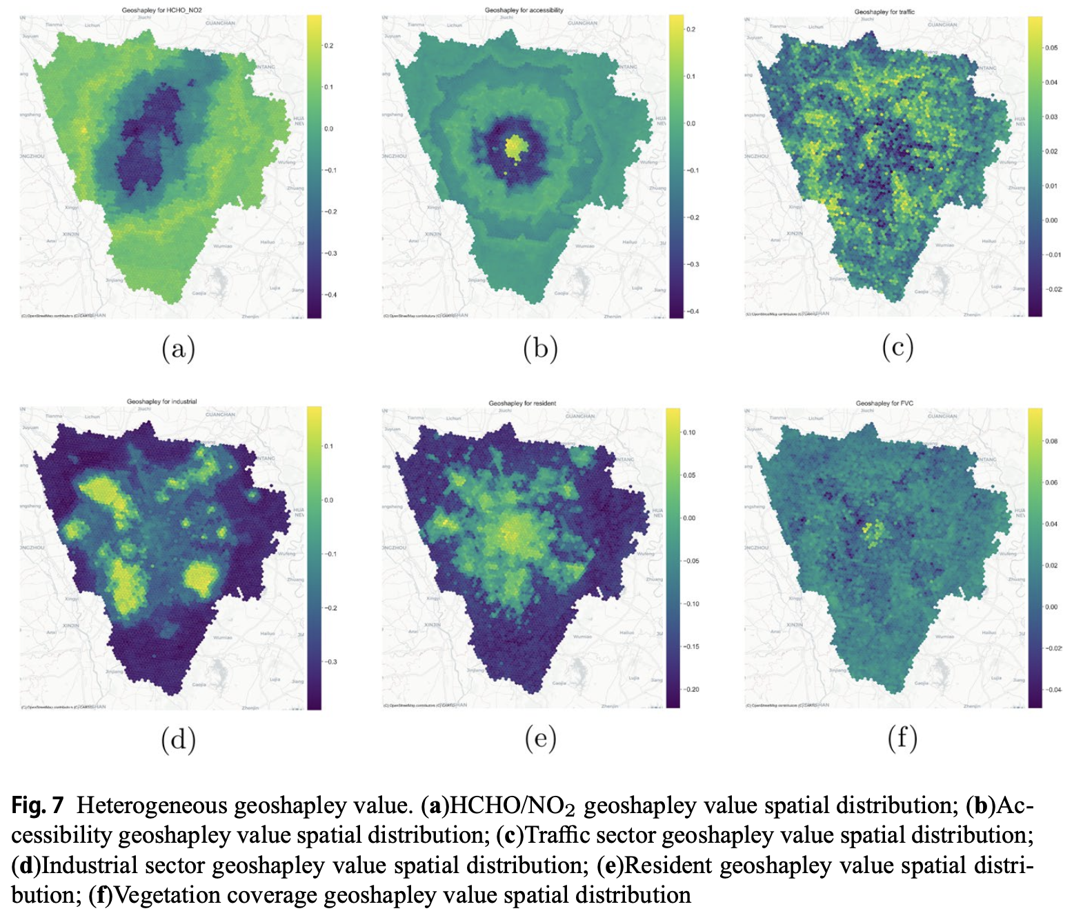
摘要:Ground-level ozone pollution is a pressing urban environmental challenge shaped by complex formation mechanisms, spatial heterogeneity, and nonlinear responses to precursor emissions. Effective management requires understanding these dynamics and their drivers, including urban form and sectoral activities. This study develops a computational framework that integrates built-environment indicators, emission proxies, and satellite-derived observations within a spatial machine learning setting. The study area is partitioned into fine-grained hexagons using Uber’s H3 system, with five-dimensional (5D) built-environment indicators derived from multi-source data. Ozone sensitivity is inferred from the HCHO/NO2 ratio retrieved from Sentinel-5P, while spatial proxies for industrial, traffic, biogenic, and residential emissions are constructed from land-use, vegetation, population, and nighttime lights. Recognizing both local sources and spatial spillovers, we employ XGBoost with GeoShapley to predict ozone concentrations and interpret their nonlinear and spatially varying effects. Results reveal heterogeneous impacts of urban form and emissions, supporting differentiated mitigation strategies and advancing spatially interpretable machine learning in air quality research.
论文类型:期刊论文
论文编号:135
卷号:19
是否译文:否
发表时间:2026-05-29
收录刊物:SCI
发布期刊链接:https://link.springer.com/article/10.1007/s12061-026-09904-1
 报考该导师研究生的方式